Do I need to carry out an Environmental Impact Assessment (EIA) in order to set up an aquaculture farm?
If a project is likely to have a significant effect on the environment, an EIA must be carried out before Read More...
Further Info
How are shellfish beds classified?
Shellfish beds are classified according to the levels of bacterial contamination in shellfish flesh. An indicator of faecal contamination, E. Read More...
Further Info
How can I find out what aquaculture activities are exempt from needing a Marine Licence?
There are a number of shellfish farming activities that may be exempt from the requirement to obtain a Marine Licence. Read More...
Further Info
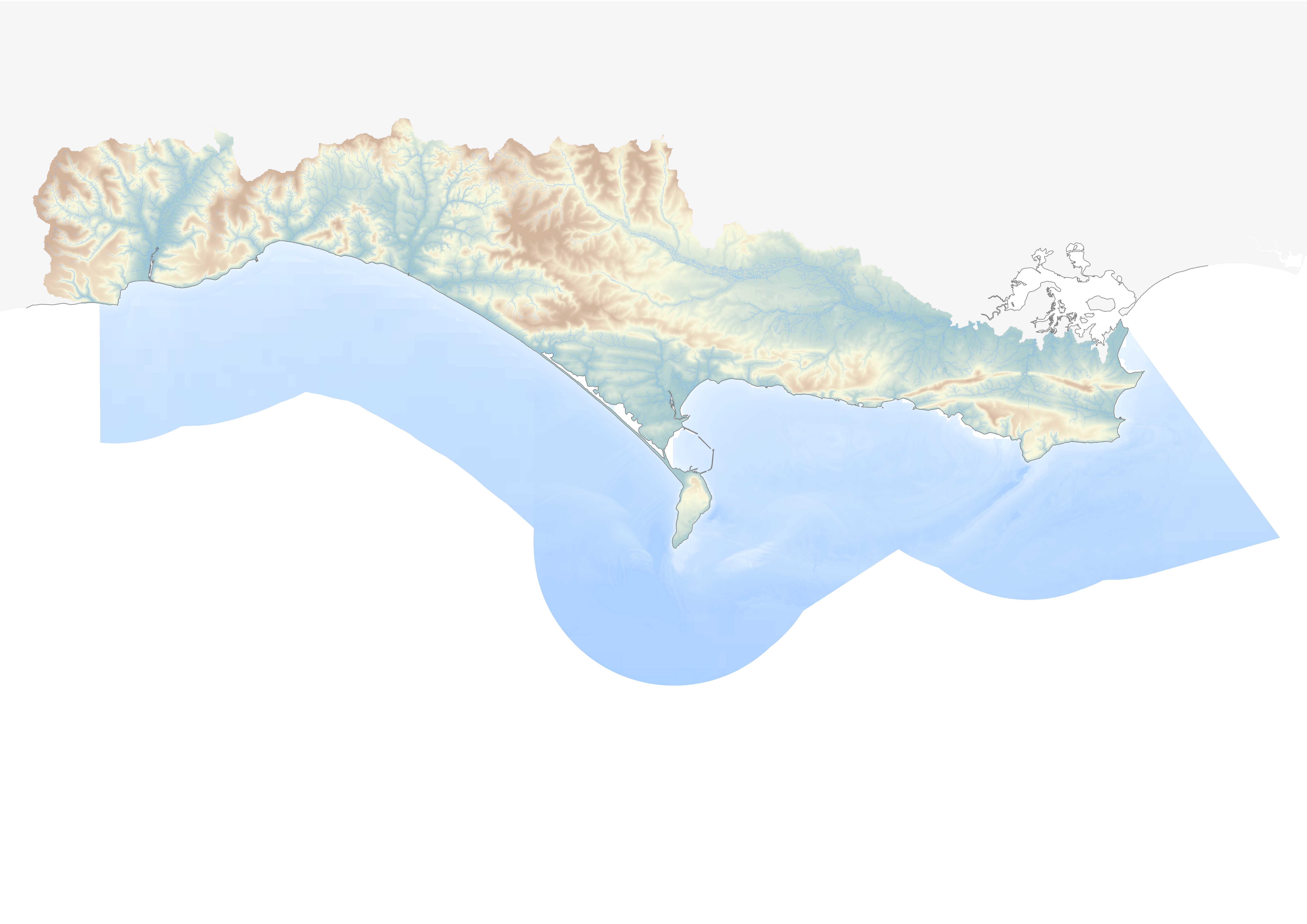
How do I find out more about current marine aquaculture operations in Dorset and what new opportunities are available?
As part of the work involved in developing a Marine Aquaculture Strategy for Dorset, the Dorset Coast Forum (DCF) have Read More...
Further Info
How do I find out who owns the intertidal and estuary seabed?
The Crown Estate have an interactive map that shows ownership of the foreshore and estuaries for England, Wales and Northern Read More...
Further Info
How do I fund a Maritime and Fisheries Fund (MFF) project?
MFF projects are paid on a reimbursement basis. This means that project costs will have to be paid by the Read More...
Further Info
I am interested in starting up a shellfish farm in Dorset. Is there a trade association that I could approach for support and guidance?
The Shellfish Association of Great Britain (SAGB) aim is to assist and promote the sustainable development of the Shellfish Industry Read More...
Further Info
I have heard that Dorset has a High Potential Opportunity (HPO) for Sustainable Aquaculture. What is a HPO and how can I get hold of a copy?
Dorset’s thriving Aquaculture sector has been identified by the Department for International Trade (DIT) as a High Potential Opportunity for Read More...
Further Info
I have heard that Pacific oysters can catch Oyster Herpes Virus. Is this a threat to human health.
Oyster Herpes Virus (OsHV-1 µvar) affects Pacific oysters and can result in high rates of shellfish mortalities. There are however Read More...
Further Info
I have heard that bivalve shellfish need to be purified before they are sold. What does purification do?
Bivalve shellfish harvested from a Class B shellfish bed require purification (also known as depuration) before being sold. Purification is Read More...
Further Info
I would like some general advice on setting up an aquaculture / shellfish farm in Dorset. Who can I speak to?
If you are after general advice or guidance about the aquaculture sector in Dorset and what opportunities there are for Read More...
Further Info
Is there a replacement for the European Maritime and Fisheries Fund (EMFF)?
Following Brexit, the Maritime and Fisheries Fund (MFF) has been introduced to bridge the gap between EMFF and a new Read More...
Further Info
What are the IFCAs and what is their role?
Inshore Fisheries and Conservation Authorities (IFCAs) replaced the Sea Fisheries Committees and lead, champion and manage a sustainable marine environment Read More...
Further Info
What are the main illnesses associated with algal toxins?
The main illnesses caused by biotoxins from Harmful Algal Blooms are Diarrhetic Shellfish Poisoning (DSP); Amnesic Shellfish Poisoning (ASP); Paralytic Read More...
Further Info
What impact do the Marine Plans have on siting and setting up a new aquaculture business?
The MMO have issued guidance on the implications and impacts of Marine Plans on new aquaculture businesses and their relationship Read More...
Further Info
What is the difference between a Several and Regulating Order?
Several Orders allow legal ownership of certain named shellfish species in a private shellfishery. Regulating Orders allow management rights to Read More...
Further Info
What is the main source of food poisoning associated with eating shellfish?
The main source of food poisoning associated with eating bivalve shellfish is from viruses, and in particular norovirus.
Further Info
What licenses and permissions are required in order to set up a new aquaculture farm?
The licenses and permissions required to set up new aquaculture operations will vary depending on the species to be farmed, Read More...
Further Info
When setting up a new aquaculture farm, what assessment of environmental impacts are required for European and Ramsar marine conservation sites?
Even when a full Environmental Impact Assessment is not required (EIA), a Habitats Risk Assessments (HRA) is normally needed when Read More...
Further Info
Where can I find out more about the different species that can be farmed in Dorset and East Devon waters?
A good place to find out more about the different species commonly cultivated through aquaculture is through the Aquaculture Profiles Read More...
Further Info
Where can I find out more about the different species that can be farmed in Dorset and East Devon waters?
A good place to find out more about the different species commonly cultivated through aquaculture is through the Aquaculture Profiles Read More...
Further Info
Who are Seafish?
The Sea Fish Industry Authority Seafish are a Non Departmental Public Body (NDPB) founded in 1981 by an Act of Read More...
Further Info
Who can I speak to about funding for aquaculture in Dorset and East Devon?
If you are interested in finding out more about funding for aquaculture in Dorset and East Devon, then the Dorset Read More...
Further Info
Who do I contact to obtain a lease on some seabed?
Seabed leases are granted by The Crown Estate. They can be contacted as follows: www.thecrownestate.co.uk/en-gb/contact/
Further Info
Who do I need to contact to get permission to set up a new aquaculture farm?
There are a number of organisations that are involved in either authorising a new aquaculture farm or as part of Read More...
Further Info